Weakly Supervised Building Segmentation from Aerial Images
Published in EEE International Geosciences and Remote Sensing Symposium (IGARSS), 2019
Muhammad Usman Rafique, Nathan Jacobs
[Paper] [Code]
Overview

Abstract
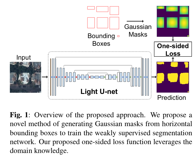
We propose a novel framework for weakly supervised semantic segmentation from aerial images. Instead of requiring labels for every pixel, our method only requires a bounding box for each building and leverages domain information to translate these into pixel-level predictions. We convert the bounding boxes into probabilistic masks, each represented using a bivariate Gaussian distribution. We propose a loss function that encompasses our domain knowledge that the bounding box is an upper bound for the object it contains. Combining these two elements significantly improves over many baseline methods. We show extensive results on a recent, large-scale dataset prepared by the United Nations Global Pulse and compare with several baselines.
Recommended citation
@inproceedings{usman2019building,
  title={Weakly Supervised Building Segmentation from Aerial Images},
  author={Rafique, M. Usman and Jacobs, Nathan},
  booktitle={IEEE International Geoscience and Remote Sensing Symposium (IGARSS)},
  year={2019}
}
